| . |
. |
Electoral Commissions |
. |
. |
| . |
. |
| . |
. |
. |
. |
. |
. |
. |
. |
. |
. |
. |
. |
. |
. |
. |
. |
| Polska / Gorzów Wielkopolski / gorzowski ... |
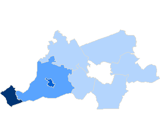 |
| gorzowski |
| No. of electoral constituency: |
13 |
| Statistics |
| Population: |
66720 |
| Area: |
1213.32 km2 |
| Population density: |
54 os/km2 |
| Electoral Statistic |
| No. of people entitled to vote: |
52322 |
| Number of wards: |
52 |
|
| |
|
|
rural commune |
|
| |
| |
|
|
rural area in urban-rural commune |
|
| |
| |
|
|
urban area in urban-rural commune |
|
| |
| |
|
|
urban commune |
|
|
| . |
. |
Types of ward |
. |
. |
| . |
. |
| . |
. |
. |
. |
. |
. |
. |
| Type |
Number |
 |
| Powszechny | 49 | 10 |
| Szpital | 1 | 0 |
| Zakład pomocy społecznej | 2 | 1 |
| total |
52 |
11 |
|
|
|


 Statistical DataLegal ActsElectoral BodiesElection Committees and CandidatesTurnoutResultsSearchDocumentsCreated by