| . |
. |
Electoral Commissions |
. |
. |
| . |
. |
| . |
. |
. |
. |
. |
. |
. |
. |
. |
. |
. |
. |
. |
. |
. |
. |
| Polska / Warszawa 2 / gostyniński ... |
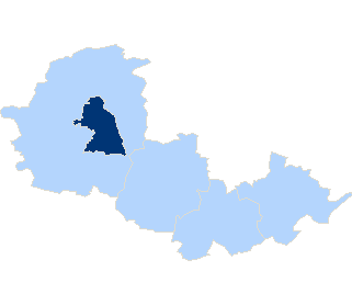 |
| gostyniński |
| No. of electoral constituency: |
5 |
| Statistics |
| Population: |
47285 |
| Area: |
615.56 km2 |
| Population density: |
76 os/km2 |
| Electoral Statistic |
| No. of people entitled to vote: |
38347 |
| Number of wards: |
39 |
|
| |
|
|
rural commune |
|
| |
| |
|
|
rural area in urban-rural commune |
|
| |
| |
|
|
urban area in urban-rural commune |
|
| |
| |
|
|
urban commune |
|
|
| . |
. |
Types of ward |
. |
. |
| . |
. |
| . |
. |
. |
. |
. |
. |
. |
| Type |
Number |
 |
| Powszechny | 35 | 7 |
| Szpital | 2 | 0 |
| Zakład pomocy społecznej | 2 | 2 |
| total |
39 |
9 |
|
|
|


 Statistical DataLegal ActsElectoral BodiesElection Committees and CandidatesTurnoutResultsSearchDocumentsCreated by